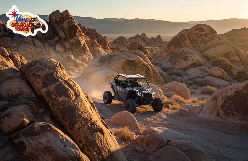
Geological Wonders You Can Only See While Off‑Roading in the Mojave Desert
Off-roading in the Mojave Desert opens up access to stunning geological formations rarely seen from main roads. The southern Mojave Desert looks empty at first glance, an endless stretch of sand, rock, and sun‑bleached sky. But once you leave the pavement and follow narrow dirt tracks, an astonishing world of hidden geology appears. Ancient lava flows, twisted fault lines, and rainbow‑striped hills sit far from any highway pull‑out. Because most of these sites lie miles down rugged routes, the only practical way to reach them is by off‑roading in the Mojave Desert.
Below is a deep, easy‑to‑read guide to the region’s most remarkable rock features that reward adventurous drivers. You will learn how each wonder formed, what makes it rare, and how to visit responsibly without harming this fragile landscape.
Why the Southern Mojave Is a Geologist’s Dream
The southern strip of the Mojave Desert, stretching roughly from Jean, Nevada, to the California state line, sits at the crossroads of three major forces:
- Volcanism: Hundreds of once‑active vents left behind cinder cones, basalt flows, and lava tubes.
- Tectonics: Fault systems tied to the Eastern California Shear Zone break and fold rock layers, creating cliffs and tilted strata.
- Sedimentation and Erosion: Wind and brief flash floods sculpt soft sediments into bizarre shapes, while chemical weathering paints the hills vivid colors.
Because rainfall is scarce, erosion happens slowly, and delicate landforms remain exposed for thousands of years. Remote terrain keeps heavy machinery away, so when you travel these trails today, you witness an open‑air museum protected by distance rather than fences.
1. Lava Tubes of the Cima Volcanic Field
What They Are
Around 10,000 to 100,000 years ago, thin basaltic lava surged through underground channels beneath fresh flows. As the surface cooled and hardened, molten rock drained away, leaving behind hollow “pipes” called lava tubes. Some passages collapsed long ago, but several remain intact, forming cave‑like tunnels with skylight holes overhead.
Why They’re Special
Most lava tubes in North America sit either in Hawaii or the Pacific Northwest. Finding them in the Mojave’s dry interior is rare. The longest accessible tubes here stretch more than 300 feet and still show rope‑like lava ripples along the walls.
How to Reach Them
- Trail: Aiken Mine Road (graded dirt, but rocky in spots)
- Vehicle: High‑clearance AWD or 4×4
- Directions: From Interstate 15, exit at Cima Road and follow signs toward Aiken Mine Road. After roughly 16 miles, a spur heads east to a small parking area. A short hike leads to the main skylight entrance.
Bring at least two bright flashlights per person. keep voices low as tiny bats may roost in the ceiling.
2. The Black Basalt Palisades of Aiken Mine Road
Just north of the lava tubes, an abrupt, jet‑black cliff rises from pale desert soil. This “palisade” formed when basaltic magma oozed into a tall crack, cooled, and hardened. Wind later stripped away the softer surroundings, leaving a wall of volcanic glass and columnar blocks.
Stand close and you can see thin bands of red, green, and gray minerals that crystallise at different cooling speeds. Late‑day sunlight turns the entire surface a deep, shimmering bronze.
3. Hidden Fault Lines and Earthquake Scars
The Eastern California Shear Zone
Although the famous San Andreas Fault skims the southwest edge of California, a lesser‑known sibling runs through the southern Mojave. Called the Eastern California Shear Zone, its fractures slice across desert basins, offsetting dry washes by several feet.
Off‑Road Routes Along the Fault
One dramatic segment lies south of Sandy Valley. Narrow jeep tracks follow subtle ridges created when quakes shoved earth upward. In several spots, you can step across a miniature scarp, an 18‑inch drop that formed in seconds during a historic tremor.
- Map: Search local BLM motor‑vehicle‑use maps for “Stateline Pass Road” and “Mesquite Valley Wash Track.”
- Note: The land is open, but never dig or collect fault gouge; leave science opportunities for future visitors.
Seeing an active fault in broad daylight drives home the raw power still shaping this desert.
4. Candy‑Stripe Hills: Iron, Clay, and Wind
A few miles east of Goodsprings sits a banded ridge locals call the “Candy‑Stripe Hills.” Iron‑rich clay and volcanic ash settled in horizontal layers, then ground water oxidized different minerals, producing stripes of red, yellow, and lavender. Later, faulting tilted the beds, so today the colors climb diagonally across the slope like a giant abstract painting.
You can park at the base and walk a short trail to admire the hue changes up close. Please resist the urge to take samples, footprints wash away, but missing rock layers do not.
5. Ancient Dry Lake Beds with Polygon Crusts
Lake beds (playas) dot the southern Mojave, but few travelers notice their geometric patterns. When salty mud shrinks under the scorching sun, it cracks into five‑ to seven‑sided polygons. From above, the ground looks like a giant turtle shell. Jean Dry Lake and Roach Dry Lake are the easiest to reach, yet still remote enough to require careful driving on soft silt.
Off‑Road Caution
Playas appear flat, but can hide pockets of wet clay. Keep momentum steady and avoid stopping in the lowest center. If you leave tracks, circle back over your path on exit; this concentrates impact in one zone rather than scarring new ground.
Tips for Exploring These Geological Sites
- Check tire pressure, slightly lower PSI improves traction on washboard and sand.
- Carry a paper map, GPS units can lose signal among basalt ridges.
- Travel with at least one other vehicle, Recovery help is far away.
- Visit in cooler months. October through April offers mild days and crisp nights.
- Photograph, don’t collect, removing rocks or minerals robs future visitors.
- Bring someone with you, don’t travel alone, and most importantly inform someone of your adventure as well.
What to Pack and How to Tread Lightly
You need to know how to prepare yourself for the Mojave Desert off-roading adventure to make sure you don’t get into any trouble in the middle of nowhere;
| Essential Gear | Purpose |
| Full‑size spare tire | Sharp basalt can shred sidewalls |
| Air compressor | Re‑inflate tires after sand sections |
| Headlamp plus backup light | Safe lava‑tube exploration |
| Trash bags | Pack out every scrap you bring in |
| 4 gallons extra water per person | Extreme dryness dehydrates quickly |
Leave No Trace rules apply even on motorized routes. Stay on existing tracks; the desert soil crust is alive with microbes that hold sand in place. Disturb it and wind erosion spreads.
Final Thoughts
The wonders above prove that off‑roading in the Mojave Desert is more than a thrill ride, it’s a passport to natural marvels inaccessible by any tour bus or roadside turnout. Each lava tube, tilted stripe, and fault scarp tells a chapter of Earth’s fiery and shifting past.
By using smart navigation, respecting trail boundaries, and packing out everything you pack in, you make sure these fragile sites remain intact. That way, future explorers can enjoy the same deep silence, endless horizons, and jaw‑dropping geology that greet you today. So fuel up your 4×4, air down your tires, and point your compass south: the desert’s secret rock stories are waiting.

